Utility Surveys & Subsurface Mapping
Understanding what lies beneath the surface is critical to the safe and efficient delivery of any infrastructure project. At Utility Survey & Design, we provide comprehensive utility surveying and subsurface mapping services, delivering accurate, high-quality data that reduces risk and supports informed decision-making from the outset.
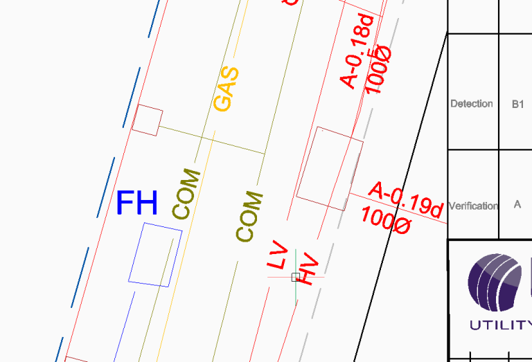
We utilise a combination of advanced detection technologies, including Ground Penetrating Radar (GPR), electromagnetic locating (EML), CCTV inspections, and sondes to identify and trace underground services with precision. Detected utilities are clearly marked on site, including indicative depths where achievable, providing immediate visibility for site teams. All located services are then accurately positioned using geospatial surveying techniques, including GNSS and total station equipment, producing detailed, survey-grade deliverables that integrate seamlessly into design and construction workflows.
Precision you can build on.
Break ground with confidence
Request a quote from Utility Survey & Design to ensure your project is supported by accurate, reliable utility data from the outset. Our surveys provide the clarity needed to plan with confidence, avoid costly delays, and maintain safe, efficient working conditions on site.